But if you're searching an area that's hundreds of miles across, that's more difficult. It would be nice to hilight areas that are within a desired range of slopes (10-30° for hiking, 30-60° for skiing).
There are GIS products that can do this:
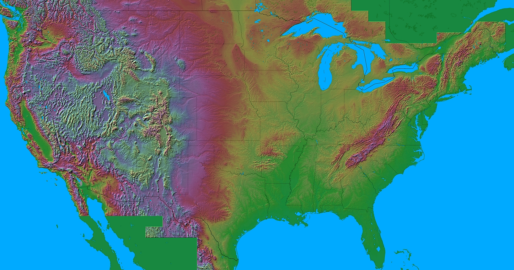
However, an easier way to access this data is to just search for shaded relief maps of an area. When looking at a relief map, areas of maximum shadow or hilight indicate places with the steepest slope.
Fortunately, relief maps are readily available for most areas.

Alaska
Alabama
Arkansas
Arizona
California
Colorado
Connecticut
Delaware
Florida
Georgia
Hawaii
Iowa
Idaho
Illinois
Indiana
Kansas
Kentucky
Louisiana
Massachusetts
Maryland
Maine
Michigan
Minnesota
Missouri
Mississippi
Montana
North Carolina
North Dakota
Nebraska
New Hampshire
New Jersey
New Mexico
Nevada
New York
Ohio
Oklahoma
Oregon
Pennsylvania
Rhode Island
South Carolina
South Dakota
Tennessee
Texas
Utah
Virginia
Vermont
Washington
Wisconsin
West Virginia
Wyoming
the entire US
(about the above maps, including the maps' legend) (archive.org backup link)
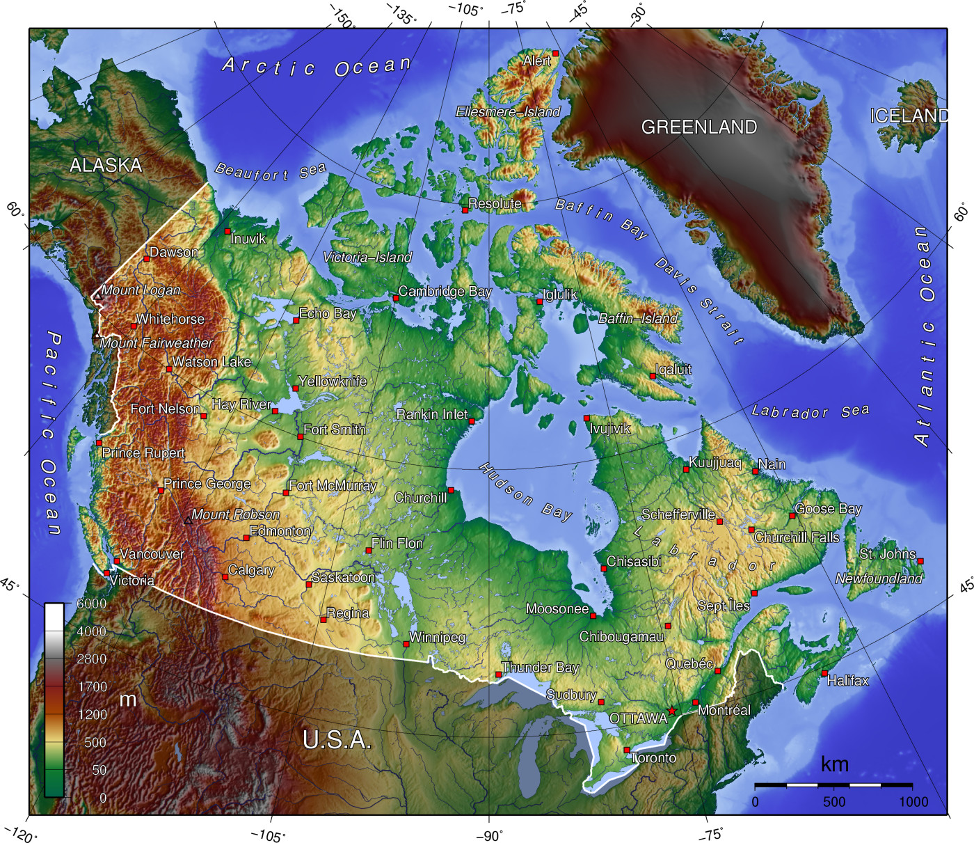
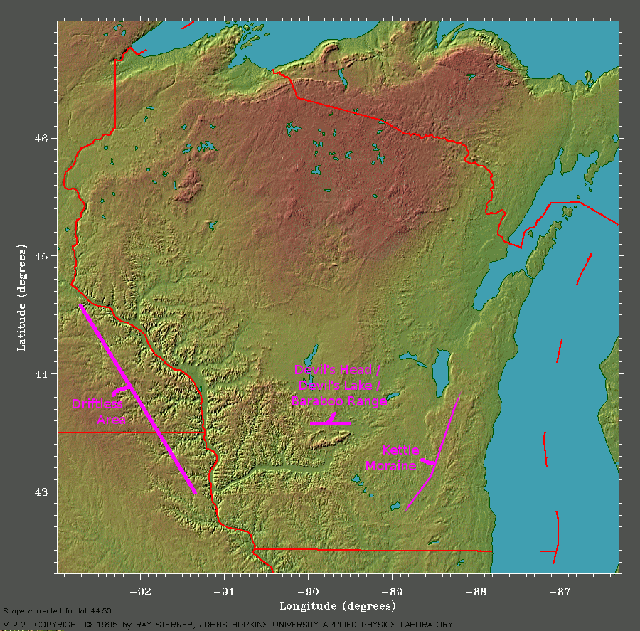
Other, similar, maps:
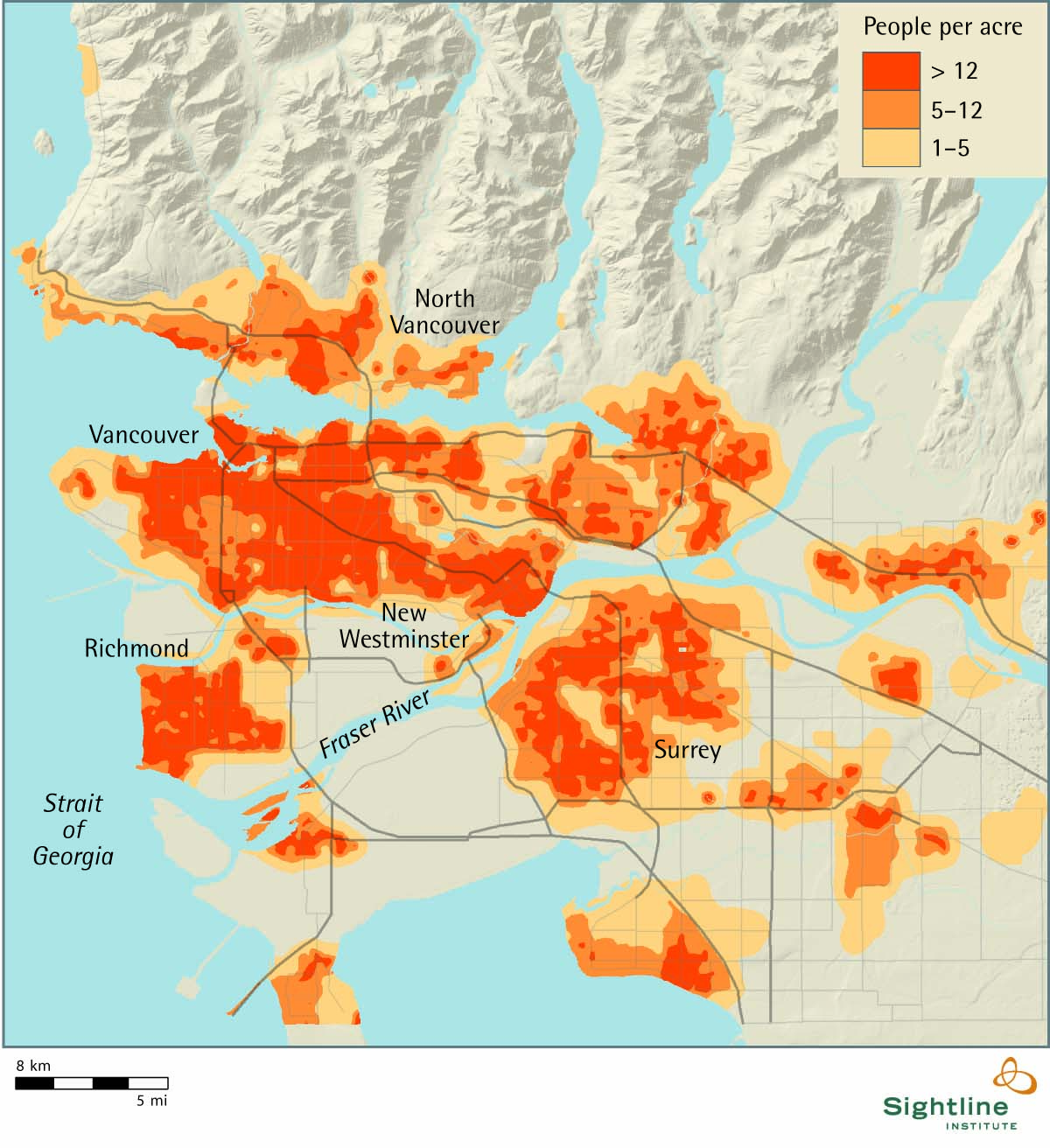
An even more valuable map is when shaded-relief is displayed alongside population-density. Rugged terrain is naturally antagonistic to high population density, for various reasons (it's hard to collect rain water, it's more difficult to construct roads/buildings). However, there are a few special places where high population is able to live adjacent to rugged terrain (eg. Vancouver, Denver), and that's exactly the kind of place I want to live. This kind of map would help me search for these locations.